Claudius Ptolemy, Geographia (Basel, 1542)
Related sources
Commentary
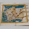
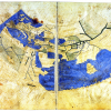
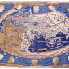
As European voyagers began to explore the New World, map makers updated Ptolemy's Geographia with new locations. This copy was edited by Sebastian Münster (1488-1552), a German cartographer, who based the text on the Greek to Latin translation of Willibald Pirckheimer (1470-1530). In addition to redesigning the maps of previous editions of Geographia, he introduced new maps. These include some of the earliest published European cartographic depictions of the Americas, as shown on this page. Münster’s new maps reflect how European knowledge of the world expanded since the publication of the Ulm Ptolemy.
Sebastian Münster was the first to label the body of water west of the continents as the Pacific Ocean. The Pacific was largely unknown to Europeans explorers until it was sighted by Vasco Núñez de Balbao in 1513, who called it the South Sea. Ferdinand Magellan in 1520 dubbed it the Pacific Ocean, as he perceived it as calm in comparison to the Atlantic. This book includes depictions of the North and South American continents, labelled ‘New World’.